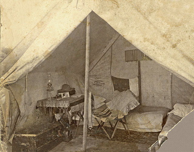
Surveyor's tent
J.B. Moore (8090)
$10.00
Glimpse inside a surveyor's tent. The term "Initial Point" has been given to several Points of Beginning for land survey and for boundary marking established in the Territorial Era. In 1864 the U.S. Congress passed legislation directing the surveying of the lands of the "Indian Territory" by a land measurement system dictated in the Land Ordinance of 1785. The ordinance set up a method that divided land into blocks called "townships," units that were six miles wide and six miles long (each township comprising thirty-six square miles of area). Each township would be further subdivided into 36 "sections," each of which was one mile square. All of this was required to be measured from a single, permanent, well-marked "Point of Beginning."


