)
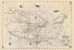
Map of Norman, Indian Territory, 1889
T.J.J. Wiggins
$10.00
Norman is the Cleveland County seat and is located approximately nineteen miles south of Oklahoma City. In the 1990s Norman overtook Lawton to become Oklahoma's third largest city, behind Oklahoma City and Tulsa. The town name honors Abner E. Norman, who led a team appointed to survey the Unassigned Lands between 1870 and 1873. As the 1889 Land Run approached, entrepreneurs formed the Norman Townsite Company to organize the town. In December 1890, the Territorial Legislature passed an act to locate the University of Oklahoma (OU) in Norman.