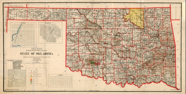
First official State of Oklahoma Map, 1907 (large): 18'' X 34'' Print
$10.00
The original Oklahoma counties, which numbered seventy-five, were designated at the Constitutional Convention. In 1909 Harmon County was formed from a portion of Greer County. In 1912 Cotton County separated from Comanche County, creating the seventy-seventh county that finalized Oklahoma's present configuration. (Image #Okshmap.0007)


