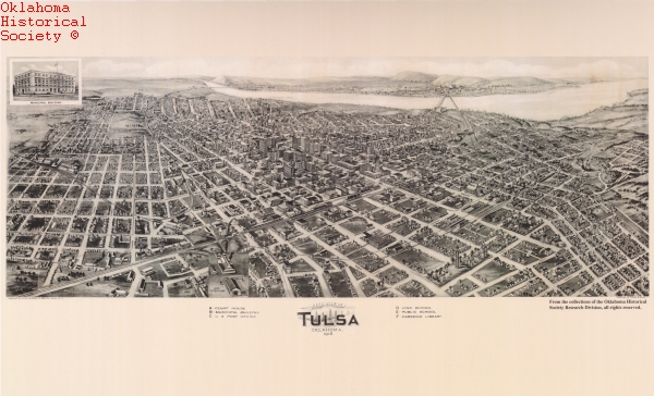
Birds-Eye View of Tulsa, 1918: 17'' X 27'' Print
$10.00
The last known birds-eye-view of an Oklahoma municipality, this Tulsa map was drawn by T. M. Fowler. The Tulsa Chamber of Commerce purchased the sketch to promote the United Confederate Veterans' national reunion that the city hosted that year. The view depicts the monumental growth of Tulsa, which can be attributed to the area's developing oil industry. At the turn of the twentieth century the small village held 1,390 people, but by 1920 the population stood at 73,075. (Image #Ctpmap.Tulsa.0003B)


