Contact Us | Press Room

Oklahoma Historical Society - Collect, Preserve, Share Skip to Content
  • Oklahoma History Center
    • About OHC
    • Visitor Info
    • Exhibits
    • Classes & Events
    • Education
    • Facility Use
    • Blog
    • CafĂ©
    • Shop
    • Contact Us
    • More...
  • Research Center
    • Oklahoma Resources
    • Genealogy
    • Records
    • Books
    • Indian Records
    • Photographs
    • Manuscripts
    • Newspapers
    • Maps
    • Oral Histories
    • Film & Video
    • Orders & Fees
    • Search Catalog
    • More...
  • Museums and Sites
    • Museums
    • Historic Homes
    • Military Sites
    • Affiliates
    • Historic Markers
    • More...
  • State Historic Preservation Office
    • National Register
    • Section 106
    • Tax Credits
    • Farm & Ranch
    • Special Events
    • HPRC
    • SHPO Staff
    • More...
  • Publications
    • Chronicles of Oklahoma
    • Encyclopedia
    • Books in Print
    • More...
  • About
    • History
    • Podcasts
    • Annual Meeting
    • OHS Extra! Newsletter
    • Board of Directors
    • Jobs Opportunities
    • Contact Us
    • Press Room
    • More...
  • Learn
  • Calendar
  • Support
    • Membership
    • Giving
    • Annual Giving
    • Naming Opportunities
    • Endowment/Planned Giving
    • Monogrammed Brick Locator
    • Volunteer
    • More...
none
Home > Store > Maps > Historic Maps > Indian Ancestral ...
Sign In or Register | View Cart | Checkout
Indian Ancestral Lands

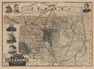
Indian Ancestral Lands: 18'' x 26'' Print

$10.00

Indian land areas judicially established 1978, published by the U.S. Geological Survey.  This map portrays the results of cases before the U. S. Indian Claims Commission or U. S. Court of Claims in which an American Indian tribe proved its original tribal occupancy of a tract within the continental United States (Image #HISMAP.0030; Print).


You might also like...

Home-Seekers Mecca Map - 1889
$10.00
Indian Territory, Prior to 1889
Indian Territory, Prior to 1889: 18'' X 24'' Print
$10.00
Bird's-eye view of Fort Reno, Oklahoma Territory, 1891
$10.00
Oklahoma's Butterfield Trail Map, 1858 - 1861
$10.00
  • Store
  • What's New
  • Books
  • Maps
  • Mouse Pads
  • Photographs
  • Playing Cards
  • Puzzles
  • Research Orders
Contact the Store
Shipping Policies
Research Request Policies

Oklahoma History Center 800 Nazih Zuhdi Drive, Oklahoma City, OK 73105
Site Index | Contact Us | Privacy